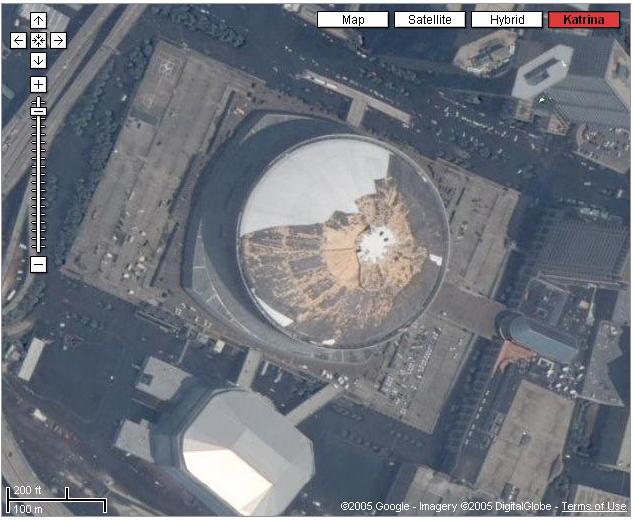
Google Maps (http://maps.google.com) has just posted recent satellite imagery of New Orleans that allows the user to compare sections of the city pre- and post-Katrina.
There is an update link on the right side of the Google Maps home page, or you may type New Orleans in the search box.
To view the city pre-Katrina click on the satellite button. There is a red Katrina button that will display the same area post-Katrina.
I have posted a picture of the Superdome.


No comments:
Post a Comment